News
New website offers a ‘Metro View’ of Richmond community
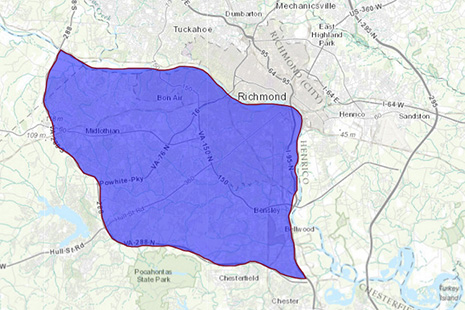
Metro View allows users to draw custom shapes for study, such as the region between the James River and State Route 288.
A new interactive website developed by the Center for Urban and Regional Analysis at Virginia Commonwealth University offers an in-depth look at the metropolitan Richmond area that cuts across the boundaries of local governments.
Metro View allows users to examine the entire 18-jurisdiction Richmond Metropolitan Statistical Area—plus five additional counties surrounding the MSA—through information about land use, development density, assessed value, age of buildings, employment, population, public facilities, environment and government plans. The website pulls together data from localities and other sources into a central location that offers both a holistic and a highly detailed perspective of the region, whether it’s a stand-alone building, a neighborhood or a suburban area that crosses multiple localities.
Users can draw their own maps that transcend local government lines and then create profiles of those geographical areas.
“We want citizens, policymakers and entrepreneurs to take a metro view of development opportunities, as well as policy issues facing the Richmond region,” said John Accordino, Ph.D., director of CURA, which is part of the L. Douglas Wilder School of Government and Public Affairs. “By providing detailed information that cuts across political boundaries, we hope to help users see opportunities and issues as they really exist in the region, rather than as limited to political jurisdictions.”
The website is supported by grants from the National Association of Realtors, the Virginia Association of Realtors and by in-kind support from the Richmond Association of Realtors.
Laura Lafayette, chief executive officer of the Richmond Association of Realtors, said Metro View will become an indispensable resource for the region.

“We’re really excited about the potential of Metro View. On the one hand, Metro View provides the kind of detailed, geographically specific data and mapping that will enable users to make decisions about where to locate a housing development, a new business, etc.,” she said. “On the other hand, the trend analysis that is possible within Metro View will enable policymakers to have data-driven conversations about future growth patterns within the region.”
The website can be found at metroview.vcu.edu.